Log in
All resources
Create a design
505 Free Artworks of Atlantic Ocean
harvard university
marine animals
ernst mayr library
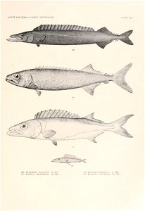
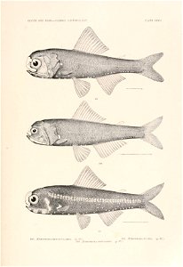
deep-sea fishing
pelagic fish
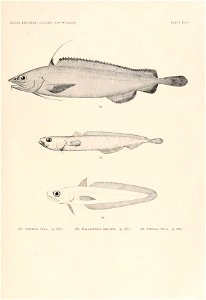
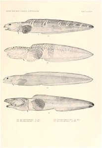
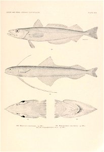
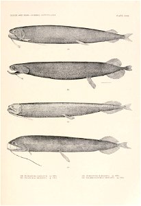
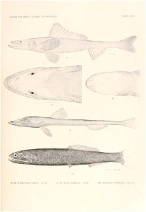
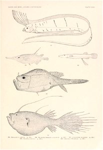
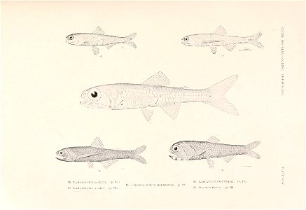
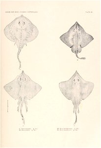
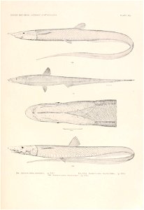
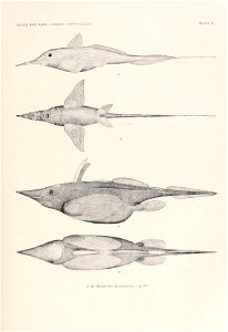
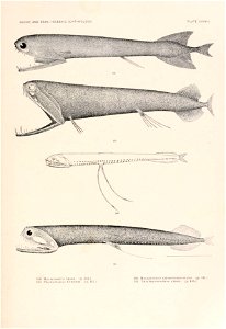
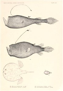
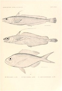
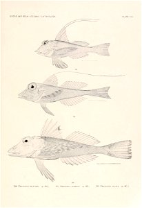
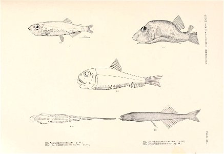
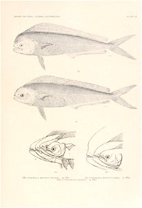
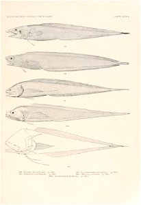
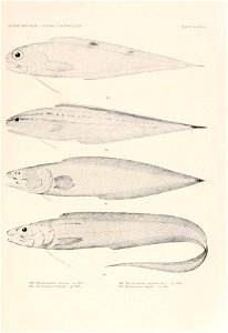
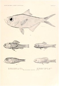
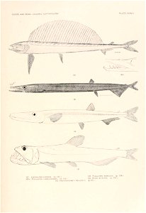
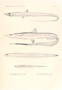
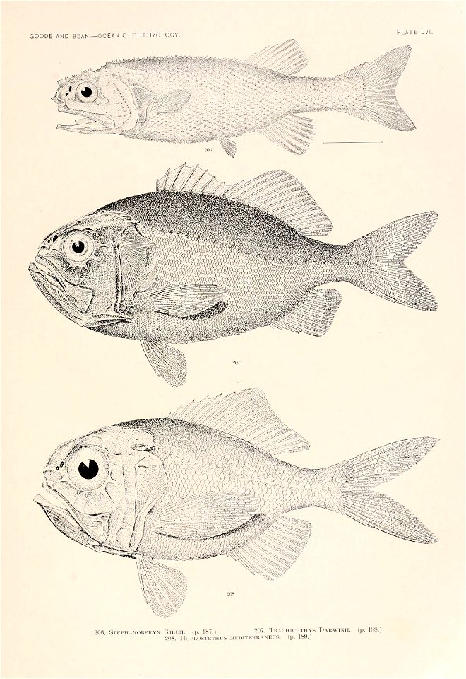
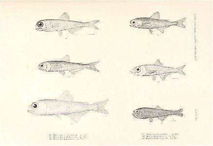
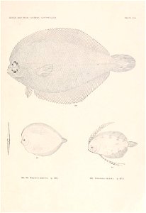
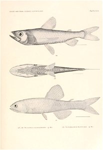
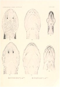
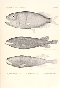
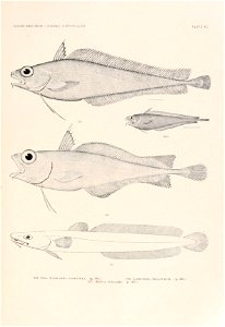
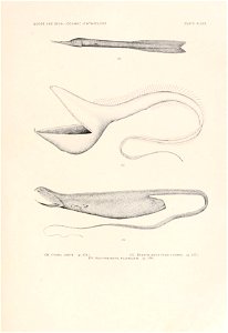
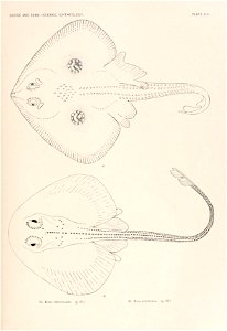
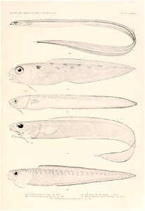
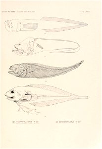
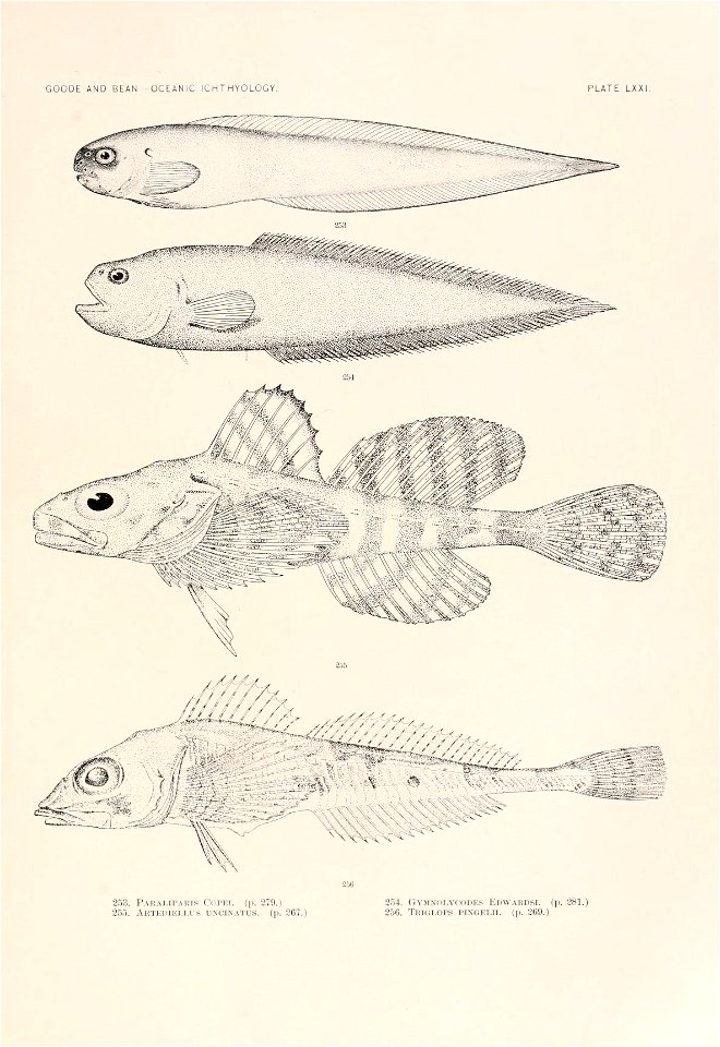
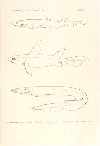
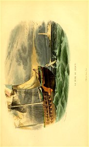
oceanic ichthyology. v.22 atlas.
#colorourcollections
color our collections
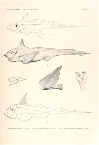
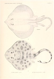
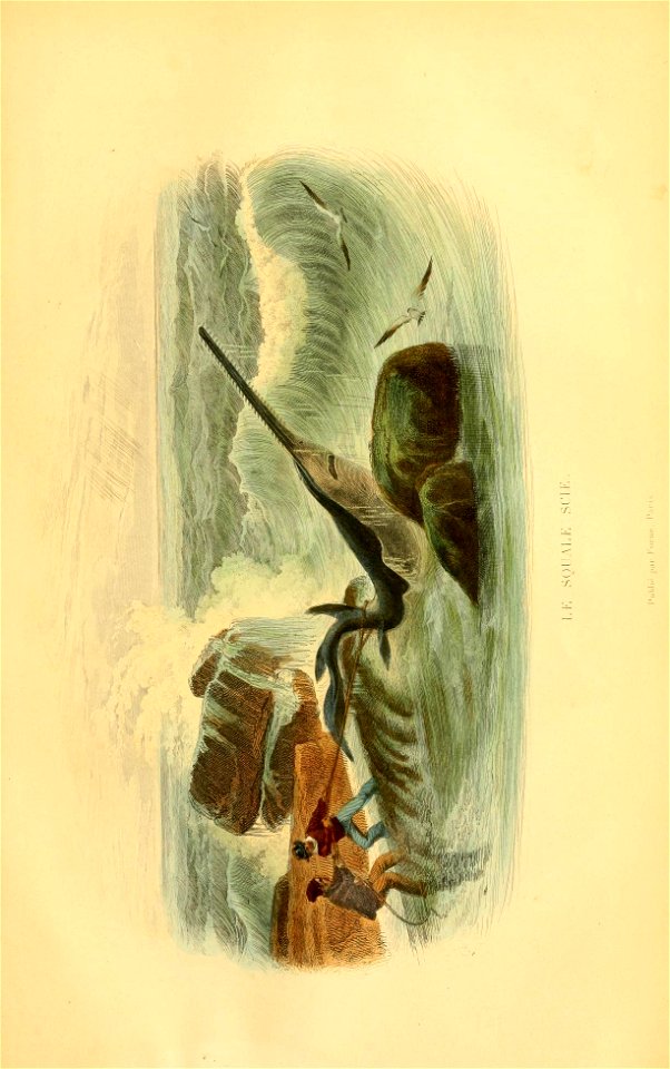
shark
fisk
harvard university
atlantic ocean
harvard university
atlantic ocean
harvard university
atlantic ocean
harvard university
atlantic ocean
harvard university
atlantic ocean
harvard university
atlantic ocean
harvard university
atlantic ocean
harvard university
atlantic ocean
harvard university
atlantic ocean
harvard university
atlantic ocean
harvard university
atlantic ocean
harvard university
atlantic ocean
harvard university
atlantic ocean
harvard university
atlantic ocean
harvard university
atlantic ocean
harvard university
atlantic ocean
harvard university
atlantic ocean
harvard university
atlantic ocean
harvard university
atlantic ocean
harvard university
atlantic ocean
harvard university
atlantic ocean
harvard university
atlantic ocean
harvard university
atlantic ocean
harvard university
atlantic ocean
harvard university
atlantic ocean
harvard university
atlantic ocean
jean-baptiste-henri delahaye
philippe buache
harvard university
atlantic ocean
harvard university
atlantic ocean
harvard university
atlantic ocean
harvard university
atlantic ocean
harvard university
atlantic ocean
harvard university
atlantic ocean
harvard university
atlantic ocean
harvard university
atlantic ocean
harvard university
atlantic ocean
harvard university
atlantic ocean
harvard university
atlantic ocean
harvard university
atlantic ocean
harvard university
atlantic ocean
harvard university
atlantic ocean
harvard university
atlantic ocean
harvard university
atlantic ocean
harvard university
atlantic ocean
harvard university
atlantic ocean
harvard university
atlantic ocean
harvard university
atlantic ocean
harvard university
atlantic ocean
harvard university
atlantic ocean
harvard university
atlantic ocean
harvard university
atlantic ocean
harvard university
atlantic ocean
harvard university
atlantic ocean
harvard university
atlantic ocean
harvard university
atlantic ocean
harvard university
atlantic ocean
harvard university
atlantic ocean
works by henry charles seppings-wright
the graphic 1887
ocean monarch by samuel walters
samuel walters
harvard university
atlantic ocean
harvard university
atlantic ocean
harvard university
atlantic ocean
harvard university
atlantic ocean
harvard university
atlantic ocean
harvard university
atlantic ocean
united states navy images from the atlantic ocean
ara almirante brown (d-10)
harvard university
atlantic ocean
harvard university
atlantic ocean
harvard university
atlantic ocean
atlantic ocean
shark
harvard university
atlantic ocean
harvard university
atlantic ocean
harvard university
atlantic ocean
harvard university
atlantic ocean
harvard university
atlantic ocean
harvard university
atlantic ocean
harvard university
atlantic ocean
harvard university
atlantic ocean
harvard university
atlantic ocean
harvard university
atlantic ocean
harvard university
atlantic ocean
harvard university
atlantic ocean
17th-century maps of the black sea
maps by willem and johannes blaeu
harvard university
atlantic ocean
the atlantic islands as resorts of health and pleasure (1878)
1870s maps of the atlantic ocean
atlantic ocean
nautical
17th-century maps of the black sea
maps by willem and johannes blaeu
atlantic ocean
shark
1670 maps of europe
hugo allardt
stanton drawings 1807-1820 vessels
savannah (ship, 1818)
shark
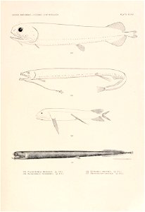
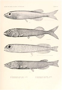
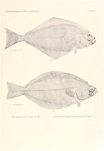
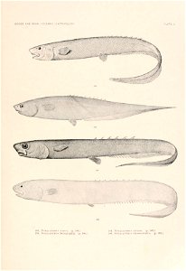
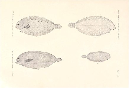
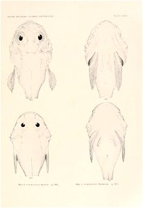
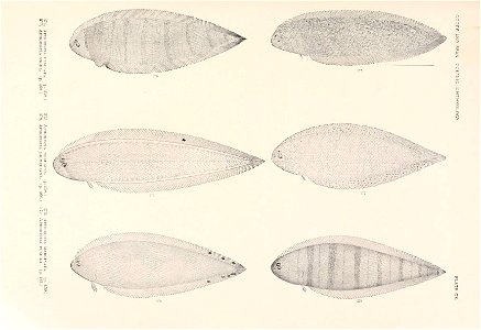
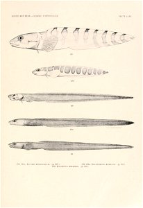
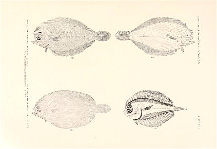
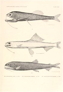
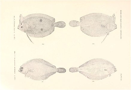
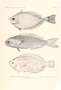
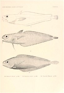
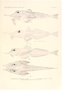
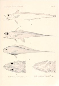
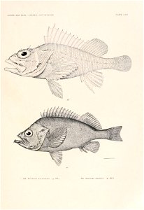
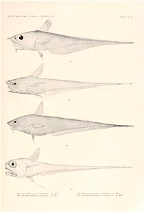
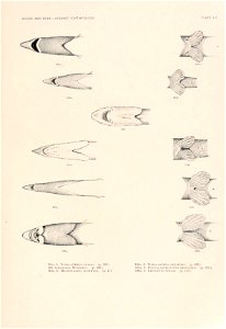
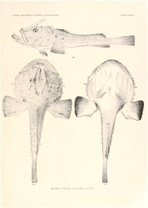
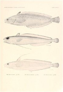
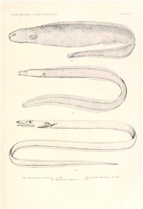
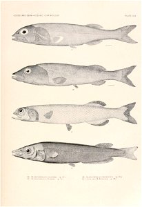
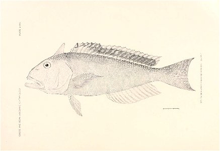
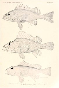
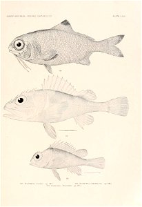
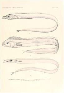
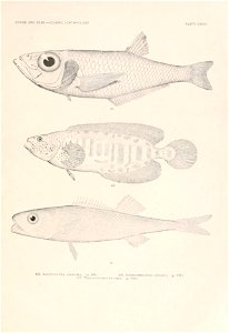
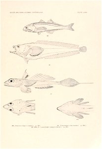
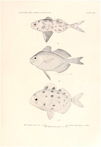
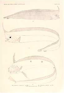
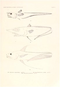
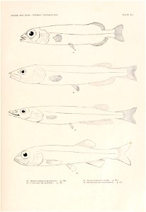
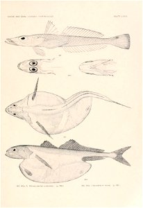
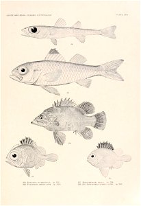
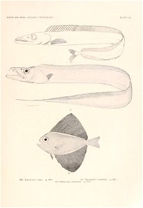
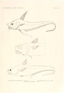
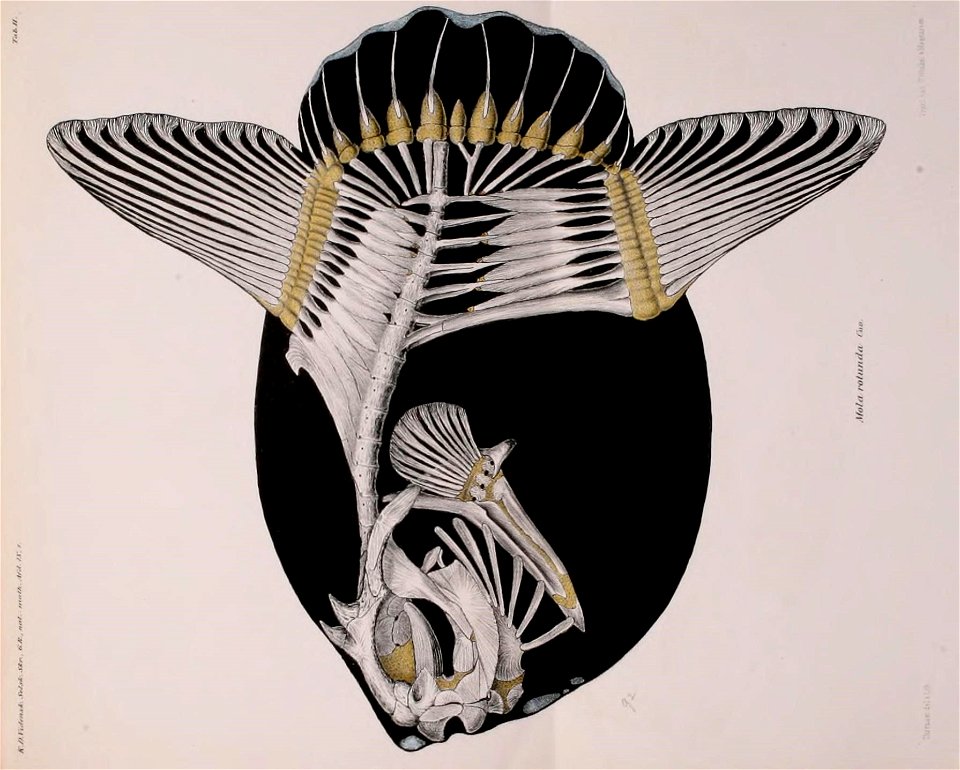
fish
stanton drawings 1807-1820 vessels
savannah (ship, 1818)
atlantic ocean
fish
old maps of the falkland islands
1901 maps of south america
shark
fish
maps from the mechanical curator collection available to georeference
maps from the mechanical curator collection
jan huygen van linschoten
baptista van doetecum
schetsboek met 45 bladen, van antoon derkinderen
symbolism
sea bird
bird
context files from gallica
lucas janszoon waghenaer
101 - 200 of 505
Next page
/ 6